-40%
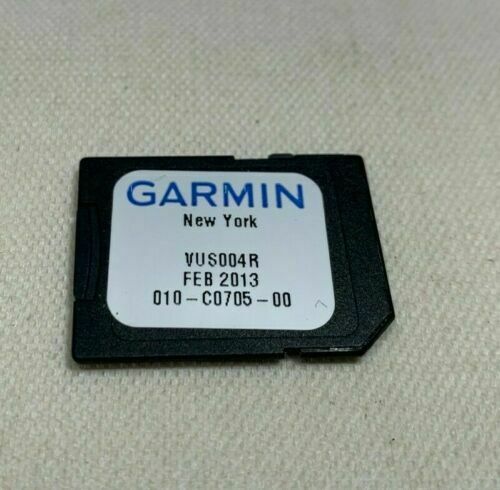
Garmin SD / MicroSD Vision Chart Card - VUS004R New York
$ 52.79
- Description
- Size Guide
Description
Garmin New York VUS004RData Card Marine Chart
010-C0705-00
Condition Description
In good working order.
May s
how minor
signs from previous use (Please refer to pictures for exact condition details)
What's Included
BlueChart Data Card.
Note: No other accessories are included. If not mentioned not included in the sale.
NOT Compatible Garmin GPS Models:
This chart is NOT compatible with GPSMAP 722sx, 7612xsv, 7610xsv, 922xs, Echomap Plus series or units with the latest update software/firmware.
VUS004R Covers:
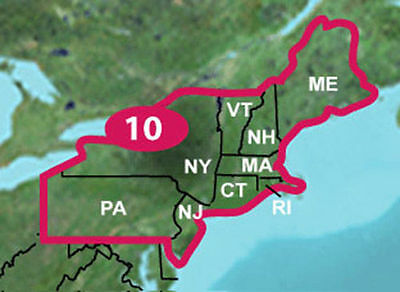
Providence to New York, includes Narragansett Bay, all of Long Island, the entire Hudson River, New York Harbor through Perth Amboy and Brick Township.
Features Include:
High resolution satellite imagery, when overlaid on the chart, provides the mariner with unparalleled situational awareness.
Aerial reference photography provides “real world” photos of ports, harbors, marinas, waterways, navigation landmarks and other points of interest, offering the mariner another powerful tool for navigating unfamiliar waters.
Mariner’s Eye View perspective provides a bird’s eye view from behind the boat showing the chart information for a quick, reliable and easy position fix.
Fish Eye View 3D perspective provides an underwater view that visually represents the sea floor according to the chart’s information.
Auto Guidance technology searches chart data to suggest the best passage to a destination.
Fishing charts allow the mariner to hide navigation data from the SD card while leaving the bottom contours and depth soundings for their next fishing adventure.
Includes tides, currents, marine services, coastal roads and points of interest.
Detailed BlueChart g2 maps are included on the card to supplement the maps on your chartplotter.
Important Note:
This is a proprietary Garmin data card; the size & shape are shown in the pictures.
Please verify the compatibility with your GPS unit before purchasing.
Please visit Garmin website for further details.
Terms & Conditions
Before placing your order, please read entirely the above Product & Condition Description and the following Terms of Sale and Conditions below:
SHIPPING
Fast shipping with tracking number.
To help your order arrive on time, please make sure your shipping address is updated and correct with eBay & PayPal prior to completing your order. For security reasons we cannot make address changes after payment has been completed. We only ship to verified PayPal shipping addresses.
TAXES
For shipments to addresses in the state of Florida, we are required by state law to collect 7% sales tax.
CONTACT US
If you have any problem with our product or service, please feel free to contact us immediately via eBay messenger system. We will do our best to solve it as quick as possible.
RETURN POLICY
After receiving the item, the buyer must contact us within 30 days.
Buyer pays return shipping.
Shipping and handling fees are non-refundable.
BUYER’S RESPONSIBILITY
The buyer must test and inspect the item rigorously and notify the seller immediately if any problem arises within the return period.
PRODUCT GUARANTEE
30-day money back guarantee. There are absolutely no other guarantees express or implied.
FEEDBACK
Please leave us a positive feedback if you feel our product and service is satisfactory, our system will do the same to you automatically.


