-40%
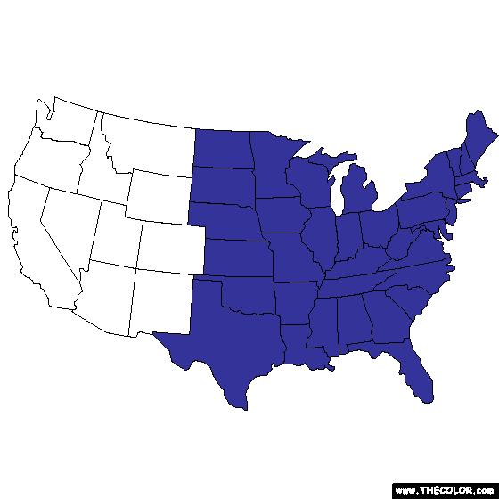
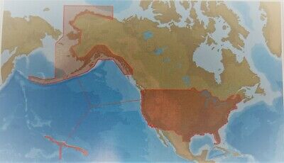
Garmin Bluechart g2 hxus039r 2012 Plug and Play Micro SD Card 010-C1018-20
$ 27.95
- Description
- Size Guide
Description
Garmin Bluechart g2 hxus039r 2012 Micro SD Card 010-C1018-20Updated to 2014
Plug and Play, works in Garmin handheld gps units that accept a micro sd card or full size sd card with adapter (included) See details below
Excellent condition
This version is not locked so it can be used in mulitple units that are compatible
BlueChart Compatibility
BlueChart g2 on microSD/SD is recommended for:
Colorado, Dakota, Oregon, nuvi 500 series; GPSMAP 62S, 64S, 60Cx/CSx, GPSMAP 76Cx/CSx, 78/ 78s /78sc, RINO 520HCx, 530HCx
BlueChart g2 on microSD/SD has limited compatibility (won't show BlueChart g2 Vision features) with:
GPSMAPs: 400 series, 500 series, 600 series, 700 series, 4000 series, 5000 series, 6000 series, 7000 series
eTrex 30 / 30x
eTrex 20 / 20x
eTrex Legend Cx / HCX
eTrex Vista Cx / HCX
eTrex Venture Cx
Colorado series
Oregon series
Auction includes:
Micro Sd card
Full size adapter
Garmin BlueChart g2
marine maps feature crisp labeling and an overall smoother presentation on your chartplotter display. In addition to the basic charts, tidal stations, currents, depth contours, IALA symbols and included fishing charts, BlueChart g2 offers improved transitioning between zoom levels and more seamless continuity across chart boundaries.
Customize Your Screens
BlueChart g2 also adds Safety Shading which allows the user to enable contour shading for all depth contours shallower than the user-defined safe depth. The fishing charts are designed to emphasize bathymetric contours with less visual clutter on the display. There's also a choice of standard 2-D direct overhead or 3-D "over-the-bow" map views for easier chart reading and orientation depending on model used.
Features found on BlueChart g2:
Seamless chart presentation
Vector object orientated data
Shaded depth contours and inter?tidal zones with spot soundings
Port plans
Tidal stations for selected countries
Aids to navigation with view range and coverage including light sectors information
Wrecks, restricted areas, anchorages, obstructions
Tidal current graphs
2D or 3D map perspective view depending on model used
Marina points of interest and slipways
Full bathymetric fishing charts providing detailed contours
Compatibility
- Colorado 300- Colorado 400c- Colorado 400i- Colorado 400t- Dakota 20- GPSMAP 6012- GPSMAP 6212- GPSMAP 7212- GPSMAP 4008- GPSMAP 4010- GPSMAP 4012- GPSMAP 420/420s- GPSMAP 4208- GPSMAP 421/421s- GPSMAP 4210- GPSMAP 4212- GPSMAP 430/430s- GPSMAP 431/431s- GPSMAP 440/440s- GPSMAP 441/441s- GPSMAP 5008- GPSMAP 5012- GPSMAP 5015- GPSMAP 520/520s- GPSMAP 5208- GPSMAP 521/521s- GPSMAP 5212- GPSMAP 5215- GPSMAP 525/525s- GPSMAP 526/526s- GPSMAP 530/530s- GPSMAP 531/531s- GPSMAP 535/535s- GPSMAP 536/536s- GPSMAP 540/540s- GPSMAP 541/541s- GPSMAP 545/545s- GPSMAP 546/546s- GPSMAP 6008- GPSMAP 60CSx- GPSMAP 60Cx- GPSMAP 620- GPSMAP 6208- GPSMAP 62s- GPSMAP 62st- GPSMAP 640- GPSMAP 7012- GPSMAP 7015- GPSMAP 720/720s- GPSMAP 7215- GPSMAP 740/740s- GPSMAP 76CSx- GPSMAP 76Cx- GPSMAP 78- GPSMAP 78s- GPSMAP 78sc- nüvi 500- nüvi 550- Oregon 200- Oregon 300- Oregon 400c- Oregon 400i- Oregon 400t- Oregon 450- Oregon 450t- Oregon 550- Oregon 550t- Rino 520HCx- Rino 530HCx
Michigan Buyers Pay 6% sales tax
** I ship items the day after the auction ends at the very latest.
* This item for sale to USA buyers.*
All sales final
SquareTrade © squaretrade warranty v2.0


